|
|
Post by Casius on May 24, 2018 7:46:30 GMT -8
This portion is awaiting map cleanup (Thank you, Mikk!) as well as some additional details to be figured out.
Notes so far: We will be working with a full ice sheet melt off, global warming model for our map (240' sear level rise), while not entirely realistic, we will be working with remaining radiation levels (after 200+ years), and we'll pin it on Wyrm minions - because why wouldn't ya? The wilderness is still alive, however unhealthy it may be, though like everything else rather reduced. Daytime temperatures will be HOT, meaning most travel will have to be done at night.
You likely will not see much of anything in the way of ruins and wreckage on the surface. Two centuries of irradiated sea water will rot away stuff like crazy on top of the fact that even under good circumstances, time itself would have cleared away much of everything. So! The anticipation is that topside will be dangerous, and it'll be pretty tough to scavenge or find much in the way of artifacts.
That is if you aren't attacked by aggressive fauna (or perhaps flora), or wyrm tainted beasts. Also, New Seattle - are we alone? Maybe, maybe not.
|
|
|
|
Post by mikkelus on May 31, 2018 16:41:28 GMT -8
Before the Bomb; 
Strikes on The Seattle Area : Estimated 2,085,810 fatalities and 5,124,400 injuries from the blast. 
200 Years later: Current Map of the Local Area 
|
|
|
|
Post by Casius on Jun 5, 2018 11:47:15 GMT -8
For reference, the pre-edit version of the map we're using. 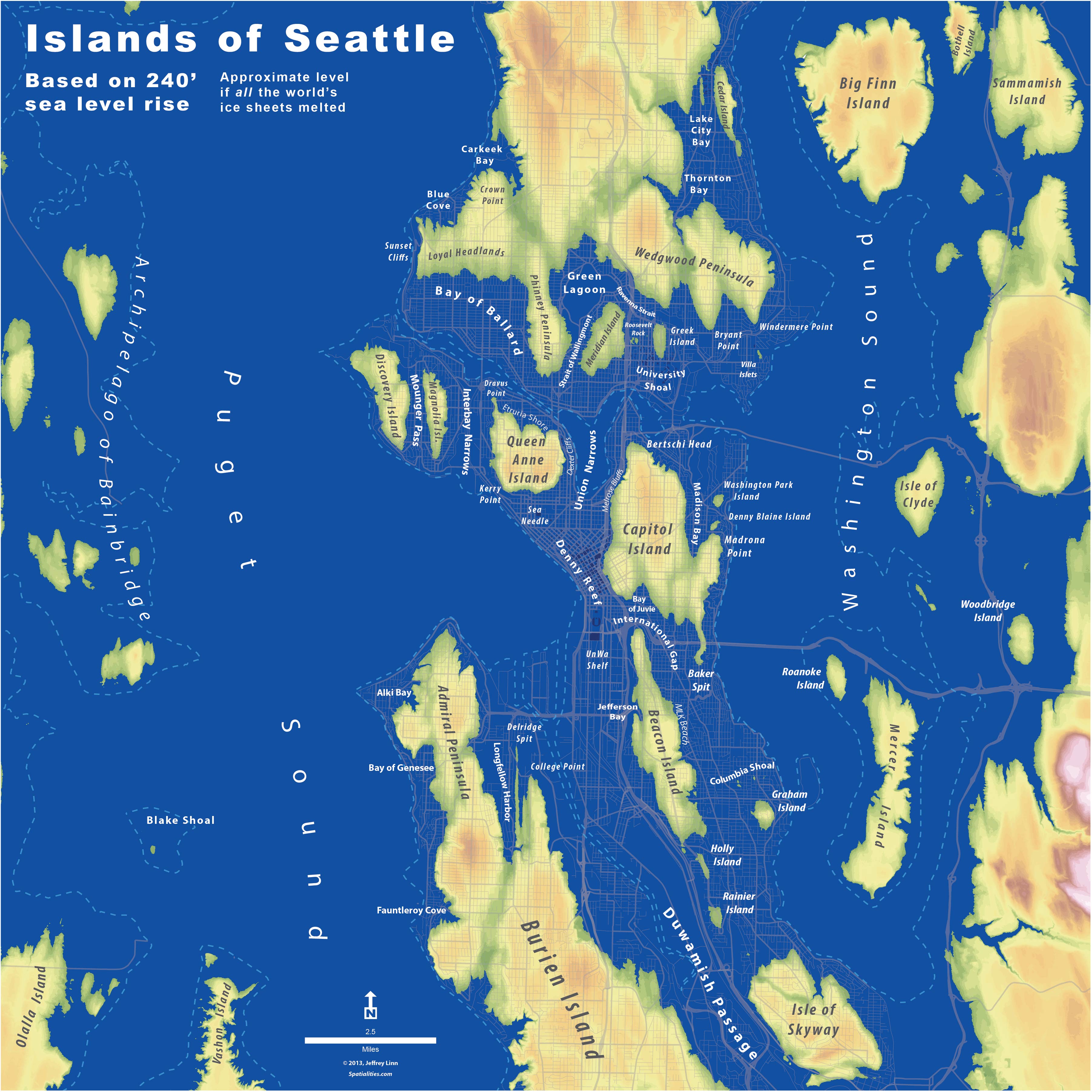 |
|


